• Get early warnings, alerts and assessment for wildfires
• Detect an anomaly (e.g., smoke or abnormal temperature) within 10km range of each IoT sensor
• Monitor urban forests in real-time through hybrid cameras (thermal and optical)
• Track live ambient factors such as air quality, particulates, and environmental variables
• Predict the possibility of a future fire
• Monitor air quality in cities, ports, schools, industrial parks, construction sites, airports & more
• Measure both indoor and outdoor air quality
• Track real-time ambient parameters that can threaten public health
• View common Air Quality Index (AQI)
• Get early warnings, alerts, and assessment for wildfires (AIRWINGSplus extension)


AIRWINGSplus enables you to:
• Get early warnings, alerts and assessment for wildfires
• Detect an anomaly (e.g., smoke or abnormal temperature) within 10km range of each IoT sensor
• Monitor urban forests in real-time through hybrid cameras (thermal and optical)
• Track live ambient factors such as air quality, particulates, and environmental variables
• Predict the possibility of a future fire
AIRWINGSplus is a comprehensive and patented technology solution, which combines Internet of Things (IoT), cellular connectivity and Artificial Intelligence (AI) for the live monitoring, measurement, and management of wildfires.
AIRWINGSplus enables you to:
Get early warnings, alerts and assessment for wildfires
Detect an anomaly (e.g., smoke or abnormal temperature) within 10km range of each IoT sensor
Monitor urban forests in real-time through hybrid cameras (thermal and optical)
Track live ambient factors such as air quality, particulates, and environmental variables
Predict the possibility of a future fire

Product Description
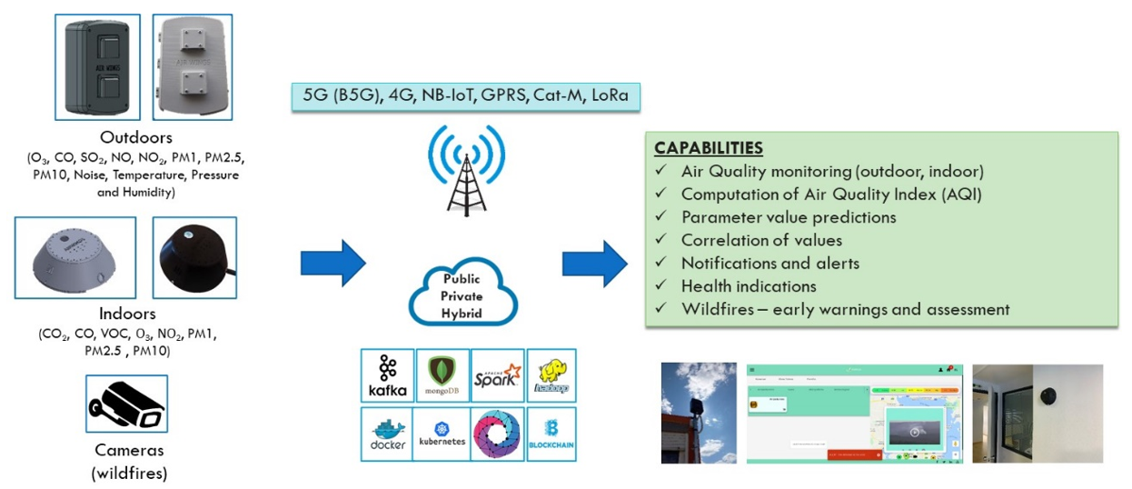
The AIRWINGSplus solution offers an integrated system of advanced hardware and software technologies for wildfire prevention and early detection needs. AIRWINGSPlus ensures the 24/7 surveillance of the selected areas. It provides early detection of fires automatically and without requiring human intervention. Fire is detected within the first 3 minutes upon the initial emergence of smoke at the site.
AIRWINGSPlus consists of:
– Cameras (hybrid, optical-thermal for 24/7 surveillance)
– Multi-sensor stations (AIRWINGSPlus devices) for environmental and meteorological monitoring
– Transmission devices for communications over 4G/5G/NB-IoT networks
– Cloud management platform (AIRWINGSPlus platform), which includes all software for early fire detection and alerting
– Artificial Intelligence algorithms for predicting the degree of risk, detecting incidents and predicting the evolution of fires
AIRWINGSplus Devices
AIRWINGSplus devices can sense the following parameters: (a) Gases: O3, CO, CO₂, SO₂, NO, NO2; (b) Particulates: PM1, PM2.5, PM10; (c) Other: Noise, Pressure, Temperature, Humidity. Additional extensions can be provided to measure other weather aspects such as wind, precipitation, and solar radiation.

Cameras
Type
– Hybrid
– Thermal and Visible
PTZ
– Pan: 0° to 360° endless
Heat Detection
– Heat Detection Distance: 3km – 5km
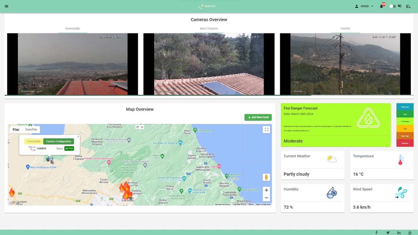
AIRWINGSPlus platform
– Device – equipment management
– Information visualization (sensor data, images, videos)
– AI for predicting the degree of risk / wildfire danger
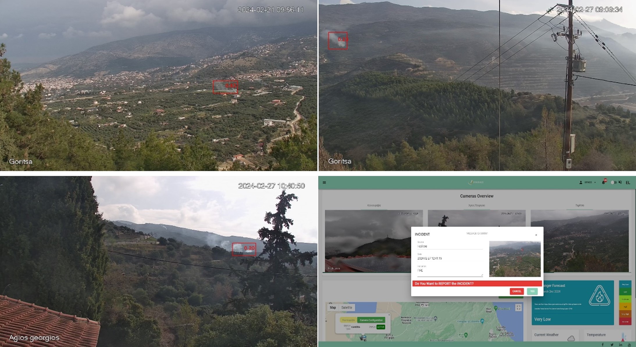
– AI for wildfire detection (sending warnings and alerts)
– Smart techniques for predicting the evolution of wildfires
– Interconnection with third party systems (civil protection, fire brigade, municipality, region)
AI Training Methodology
– Deep Neural Network Architecture
– Model training from real fire simulations
– Model operation under general and different conditions, lighting, shading and topographic features (cities, forests, parks)
– Model development based on a set of hundreds of thousands of images
– Utilization of artificial images resulting from augmentation techniques
– Model training to calculate the location of the potential source (fire, smoke), its size and the degree of confidence characterizing the specific location
Product Dashboard

Installations

Request a Demo:
To request a demo of AIRWINGSplus, please submit the form below.
Recent Articles


