

Data Sources
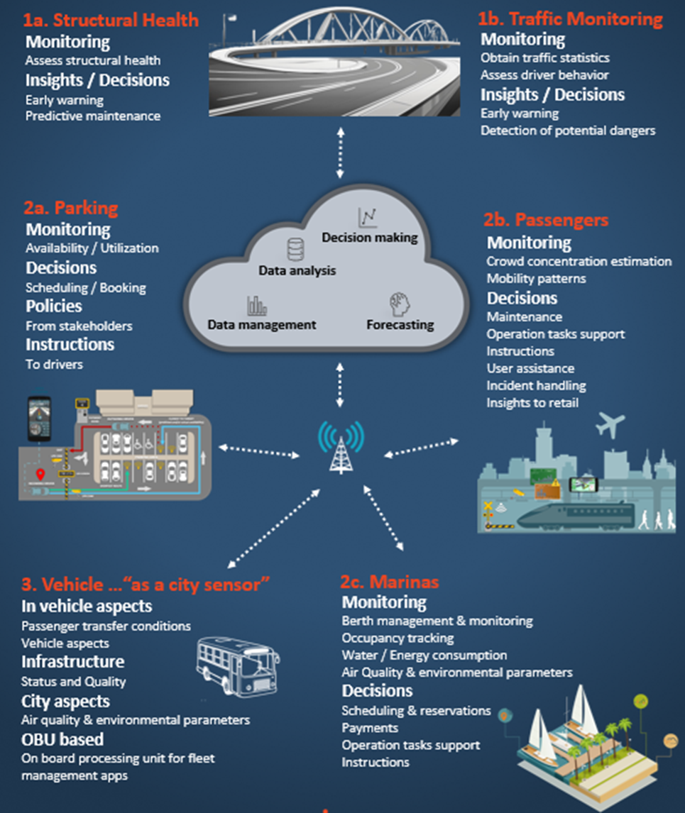
The system gathers data from a variety of sources and devices tailored to different applications. These include a Data Acquisition System with cameras installed in key infrastructures, capturing real-time video streams.
Additional data sources include fixed cameras, drones, occupancy sensors, municipal vehicles, autonomous ground vehicles (AGVs), and specialized optical and thermal cameras. Together, these devices provide comprehensive monitoring and analysis across multiple domains.
AI Algorithms
The system employs advanced IoT and AI algorithms, including machine vision, video analytics, detection models, and predictive and optimization mechanisms, for real-time monitoring, data processing, and decision-making. Video streams are analyzed to extract key parameters, with machine vision tracking objects and predictive models forecasting patterns like traffic flow, damage severity, or infrastructure performance across domains such as transport, parking, and berth management.
Visualisation Dashboards
The system features advanced visualization dashboards that provide real-time access to video streams, camera feeds, real-time notifications, monitoring data, key insights, statistics & analytics, comprehensive views of outcomes across domains, etc. Administrators can filter data by date, source, or device, receive alerts, manage devices, and access analytics for optimized decision-making and infrastructure management.
Application
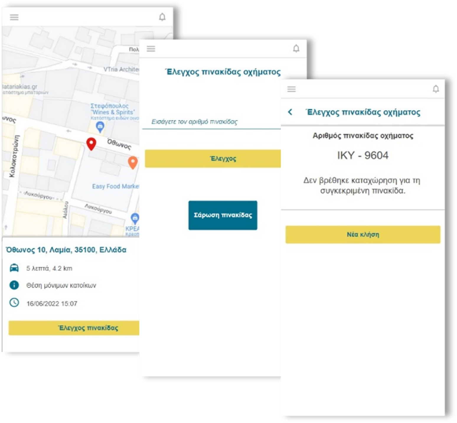
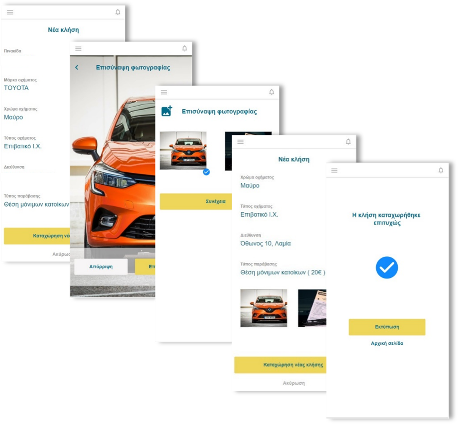
The system includes a variety of apps designed for user convenience and efficiency. These apps enable real-time booking, navigation, and payment for services like parking, marinas, and transportation. They offer features such as live updates, occupancy predictions, safety alerts, and access to historical data. Users can also manage arrivals, departures, and service usage, ensuring smooth and seamless experiences across different domains.
Structural Health Monitoring & Assessment
wi.MOVE offers a state-of-the-art approach to Proactive Public Infrastructure Asset Management and Structural Health, by collecting data from various sources such as security cameras, drones, municipal vehicles, and autonomous ground vehicles (AGVs).
Advanced AI algorithms and Deep Learning techniques process this data to assess the condition of infrastructure assets. The system generates alerts and recommendations for maintenance and safety tasks, focusing on the structural health of buildings, pavements, and roads. This proactive management approach enhances efficiency, reduces the risk of accidents, mitigates environmental pollution, and leads to significant cost savings and improved operations.
wi.MOVE Intelligent algorithms aim to proactively manage infrastructure, reducing the risk of accidents and environmental pollution.
Assessment of the condition of the infrastructure using Video Analytics
Multiple Data Sources
Data are gathered from diverse sources including fixed cameras, drones, municipal vehicles, and autonomous ground vehicles (AGVs).
Detection Model
The video streams are processed in real-time, yielding valuable parameters and features. Damage severity for each damage is also conducted.
Visualization Dashboard
The video streams, the detections and the insights derived are accessible through a powerful visualization dashboard, allowing administrators to obtain comprehensive views of the structural health inspection outcomes, real-time monitoring data, and damage detection results.
FEATURES
Structural health inspection output
Realtime monitoring & damage detection
Realtime camera feed from active devices (drones, AGVs)
Notifications and alerts on detected damage severity
Total number of damages
Total number of damages of each type (e.g. longitudinal cracks, lateral cracks, alligator cracks, potholes, manholes)
Filters: Date range, road damage type, severity, device
Inspection & management of devices
Statistics and analytics
Traffic Monitoring in Transport Infrastructures
wi.MOVE provides a cutting-edge solution for Traffic Monitoring by utilizing data from both fixed and moving cameras. Leveraging on advanced AI and Deep Learning techniques, the system provides useful insights regarding aggregated traffic statistics and assess driver behavior. Machine Vision Algorithms are utilized to detect, track and classify road users in different categories. It also detects potentially dangerous situations in real-time and issues early warnings. Predictive models forecast future traffic patterns, while an intuitive dashboard enables administrators to make informed decisions and manage traffic flow efficiently in real time.
wi.MOVE through its intelligent algorithms aims to reduce traffic congestion, risk for accidents and environmental pollution.
Transformation of multiple video streams into valuable analytics
Data Sources
The primary data source is the Data Acquisition System, which consists of cameras installed in transport infrastructures. These cameras capture real-time video footage of the traffic flow.
Detection Model
The system employs Machine Vision Algorithms for Vehicle Tracking and Classification. This model is designed to detect and classify various types of road users. The algorithms use computer vision techniques to identify and track these objects in the video streams. Input from ML-based Predictive Modeling uses the extracted metrics to forecast future traffic patterns or conditions.
Visualization Dashboard
The video streams, the inspection results and the insights derived are accessible through a powerful visualization dashboard, allowing administrators to obtain comprehensive views of the traffic monitoring outcomes in transport infrastructures, real-time monitoring data and significant metrics.
FEATURES
Traffic inspection output& Realtime monitoring
Realtime camera feed from active devices
Traffic Heatmaps
Potentially harmful situations detection:
– Dangerous Lane Changes,
U-Turns, Driving / Parking in Emergency Lanes
Filter by Date or Source
Inspection & management of devices
Statistics and analytics:
– CO2 Emissions
– Flows Per Class
– Speed
wi.MOVE
Your Co-driver for Municipality Controlled Parking Spaces or Parking Facilities
wi.MOVE is an integrated smart parking solution that offers a holistic approach to parking monitoring and management, providing useful insights about parking spaces availability in real time.
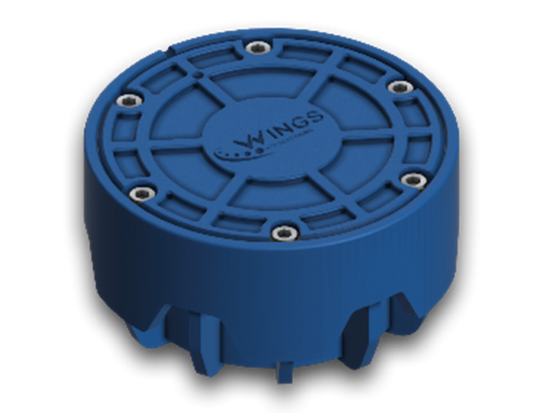
Receiving data from WINGS parking sensors and cameras, wi.MOVE is able to monitor various parameters enabling valuable, productive and cost-efficient planning of the controlled parking spaces in the long run.
Wings Parking Sensor
wi.MOVE includes a powerful low cost, energy efficient sensor able to detect the presence of a vehicle with 99% reliability and a battery life reaching up to 10 years, retrieving data and transmitting them over any available network.
Sensor Features
– Retrieves data from the field and transmits over any available network (NB-IoT, GPRS, 4G, SigFox, LoRA)
– Zero-Touch firmware upgrade and sensor calibration
– Device management
Highly Descriptive Dashboard
wi.MOVE dashboard provides real-time sensor and devices management, event detection, parking spaces occupancy trends, as well as reporting on payments, violations and more. Daily, weekly, monthly and custom reporting, tailored to the municipality or parking facility needs, as well as sales monitoring and forecasting capabilities are also provided.
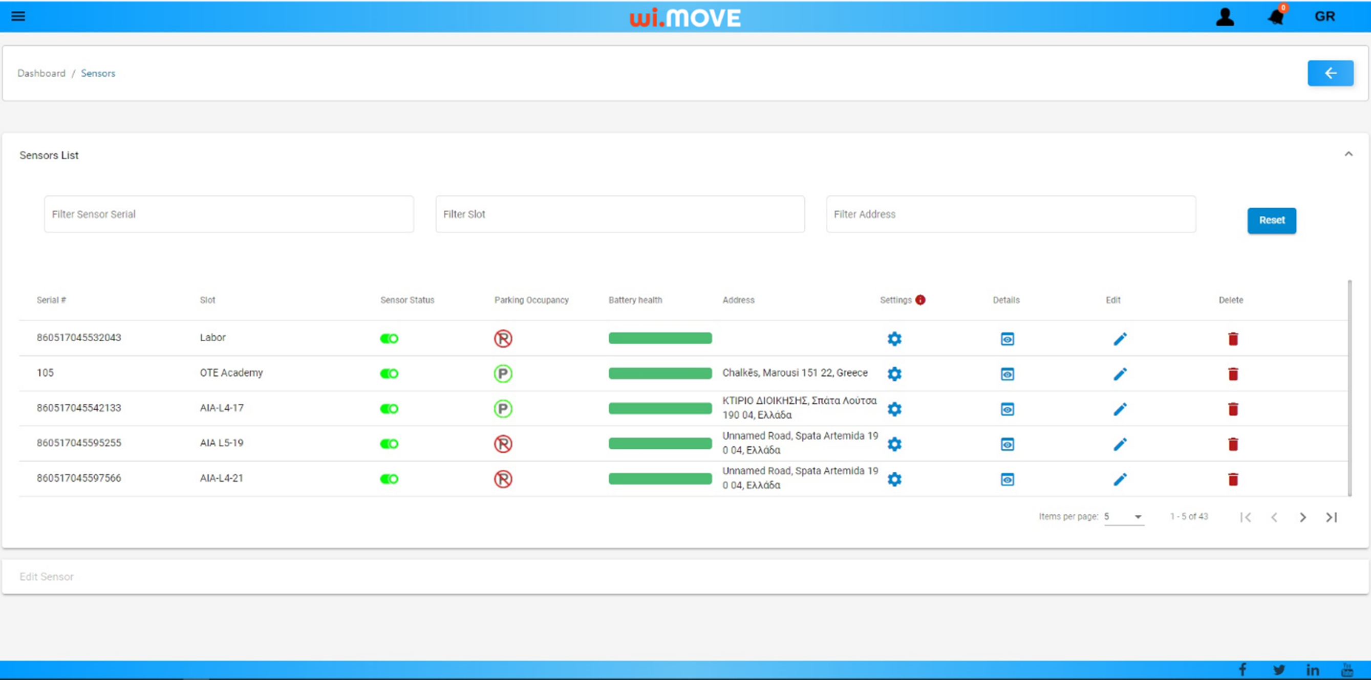
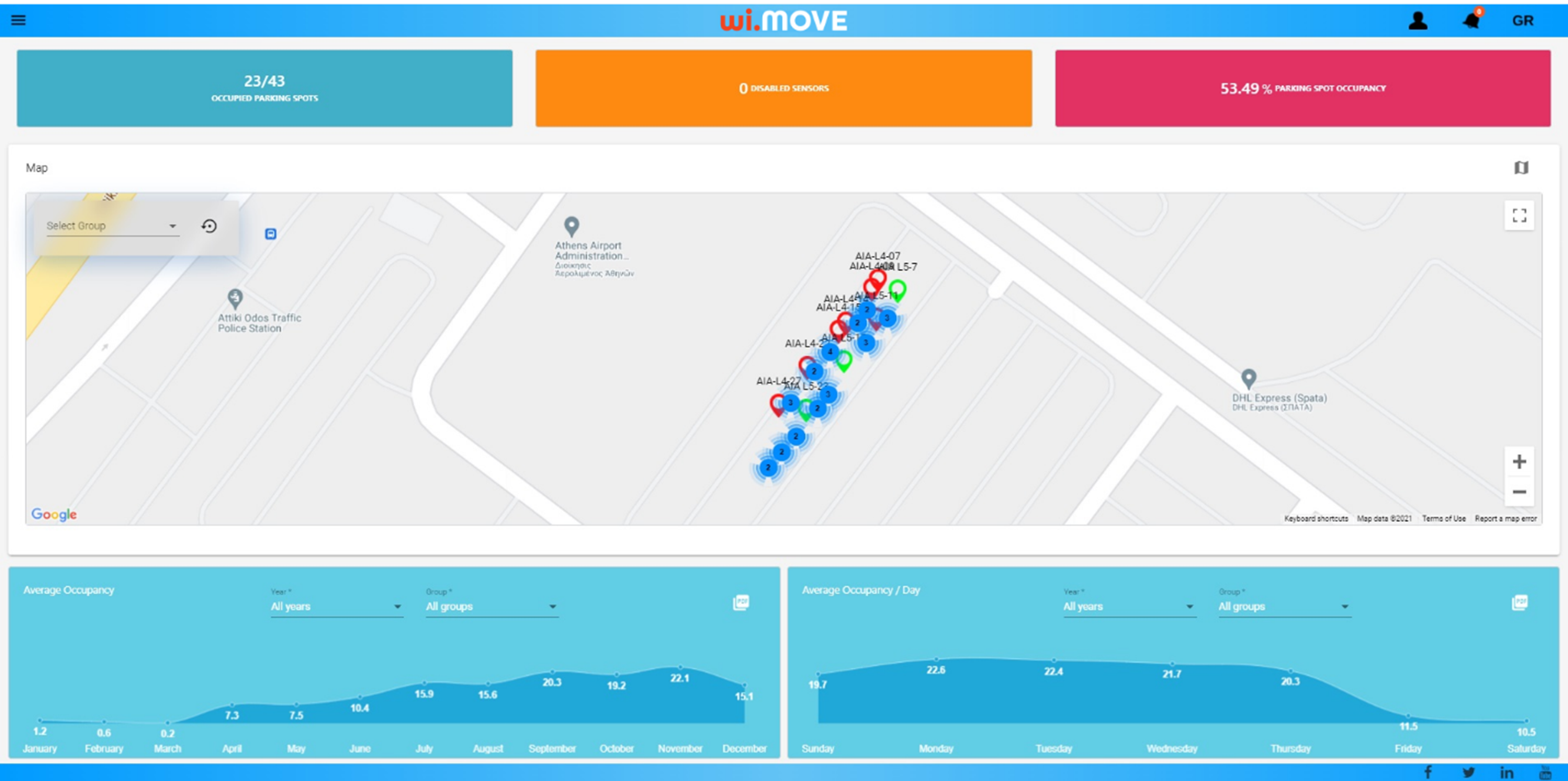
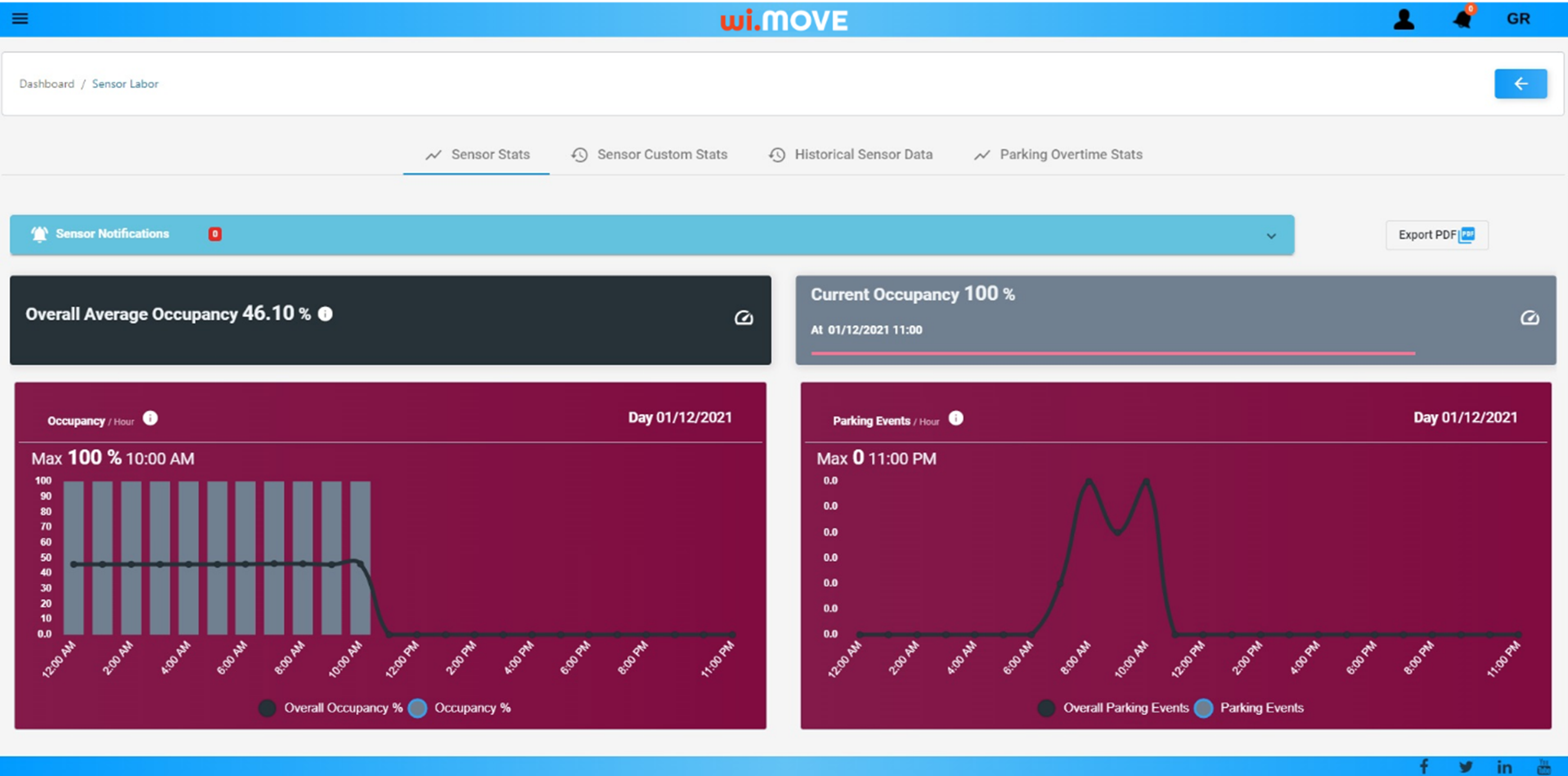
Dashboard Features
– Real-time monitoring of parking availability
– Data Visualization
– Predictive analytics to identify occupancy patterns
– Support for sensors grouping and management
– Export data in CSV format
– Retrieval and comparison of historical data and trends
– Reporting on parking availability, payments, violations
Driver’s Mobile App
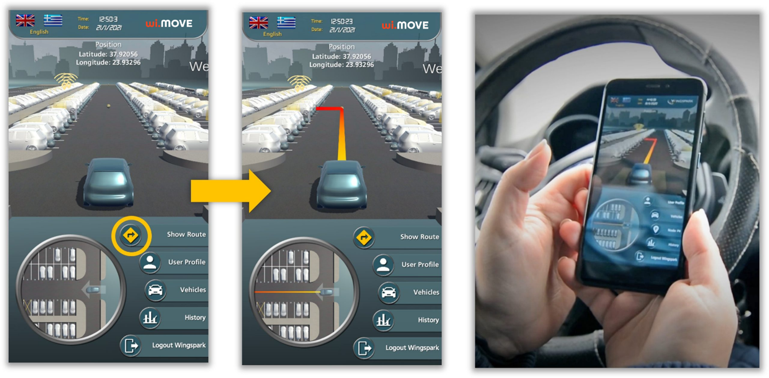
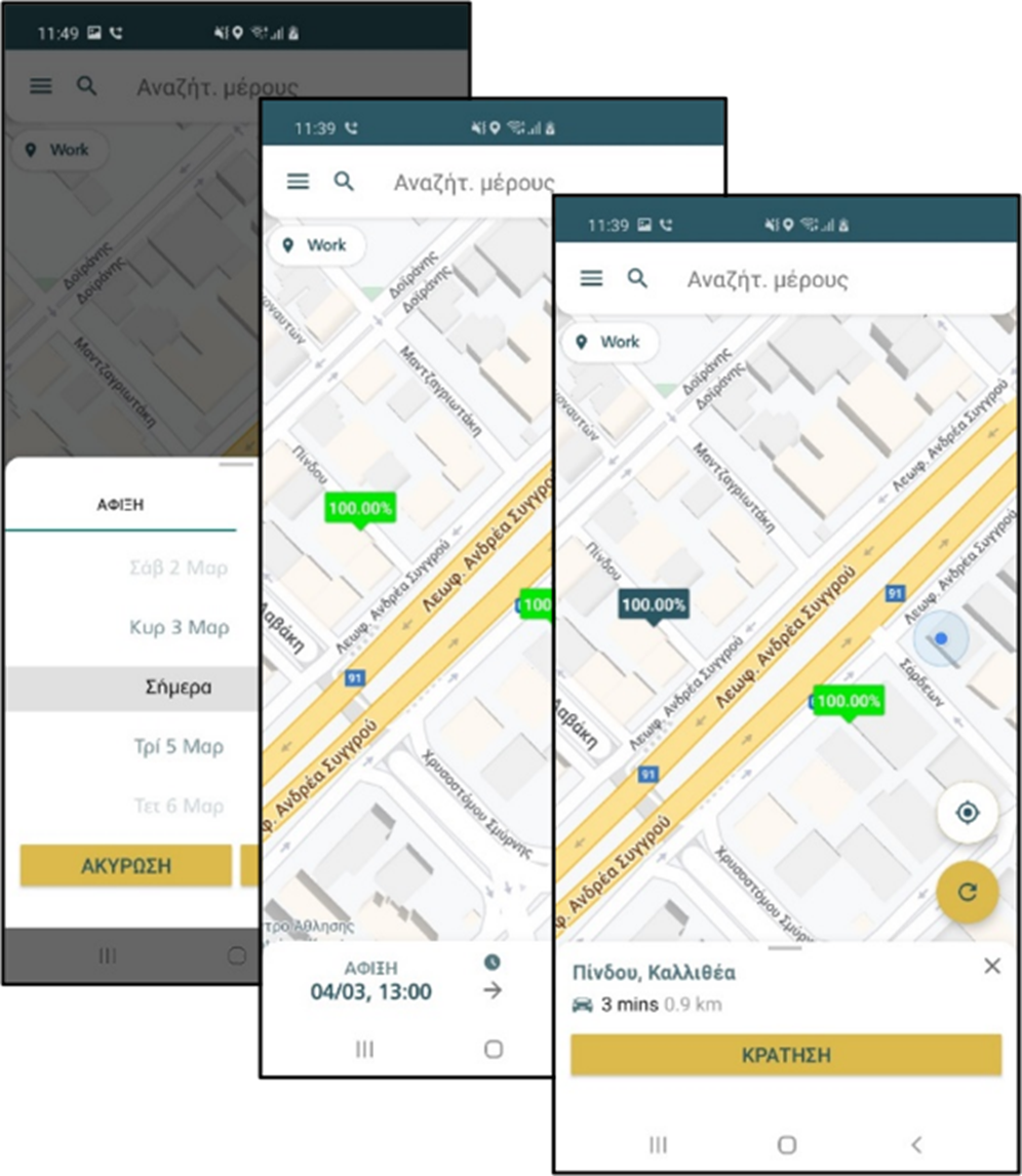
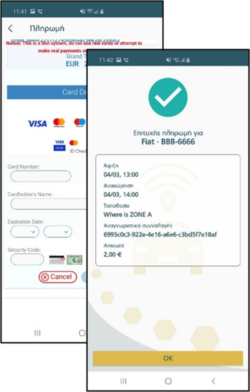
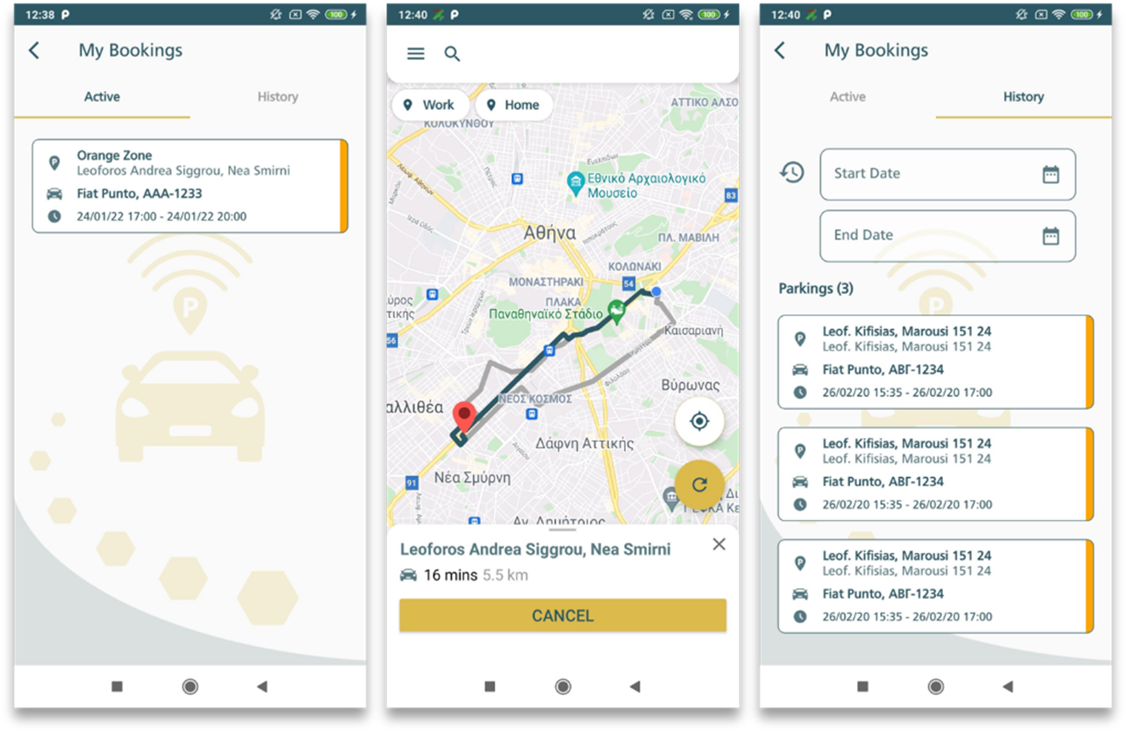
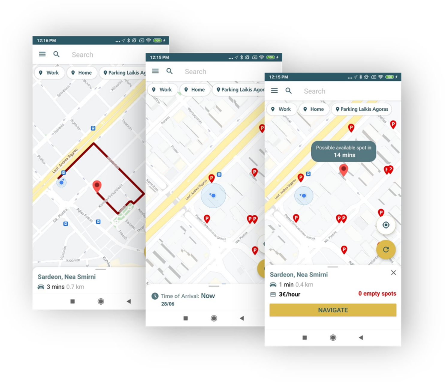
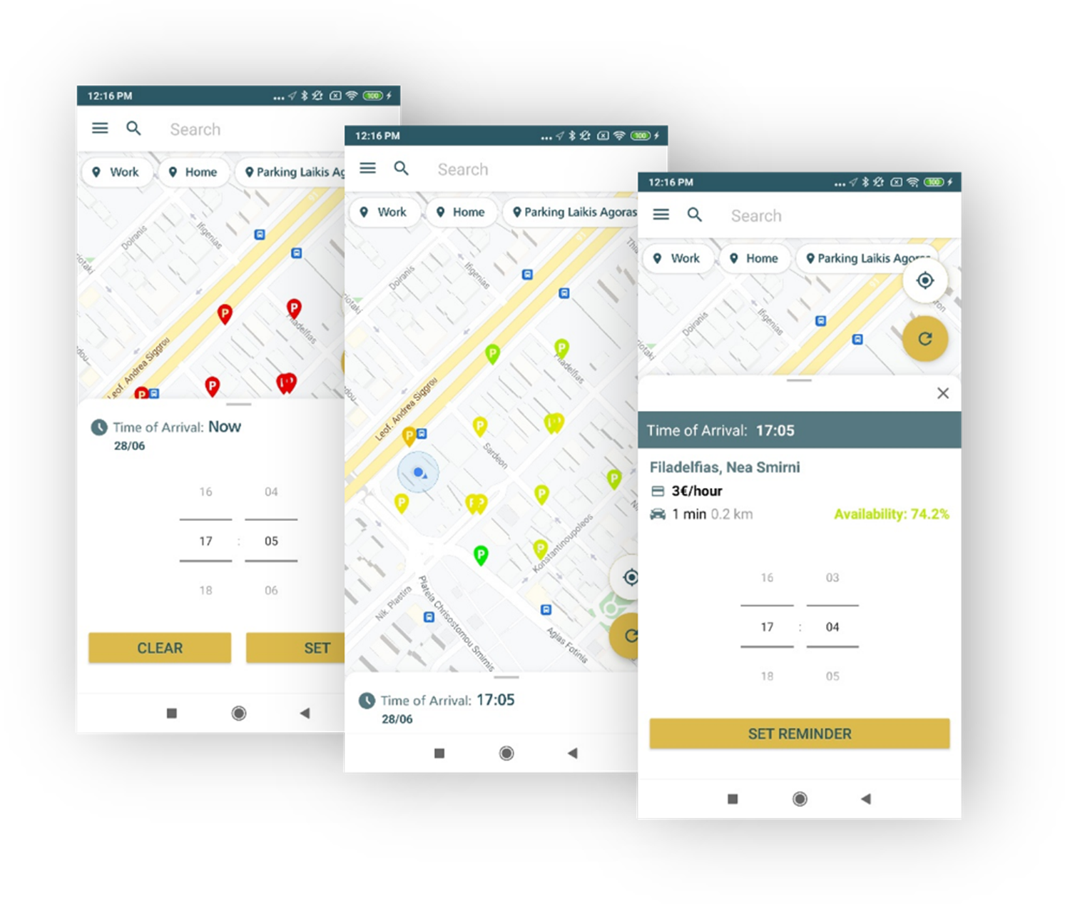
wi.MOVE mobile application provides personalized suggestions on available parking spots in the area of interest. Location search, spot identification, driver’s routing and payment all seamlessly become part of the driver’s experience. On-street, off street as well as parking for disabled people is supported.
Mobile App Features
– Visualization of the parking spots based on category (e.g., spots for disabled people) and status (free / occupied)
– Interactive maps
– Identification of occupancy patterns based on predictive analytics
– Optimal Routing to the selected spot
– Drivers reporting on parking events, payments
– Account, vehicle, favorite spots management
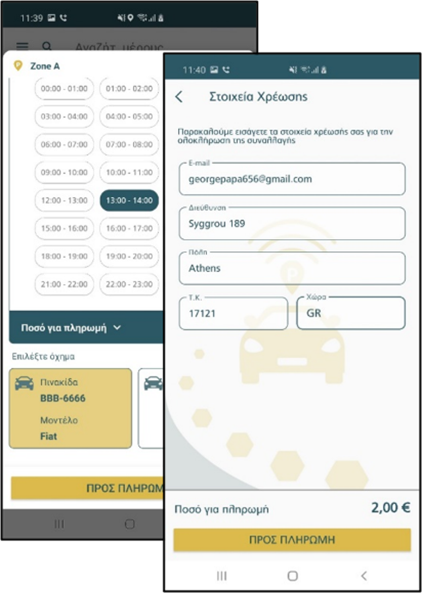
– Support for payments
– Available on Android and iOS
wi.MOVE booking a slot
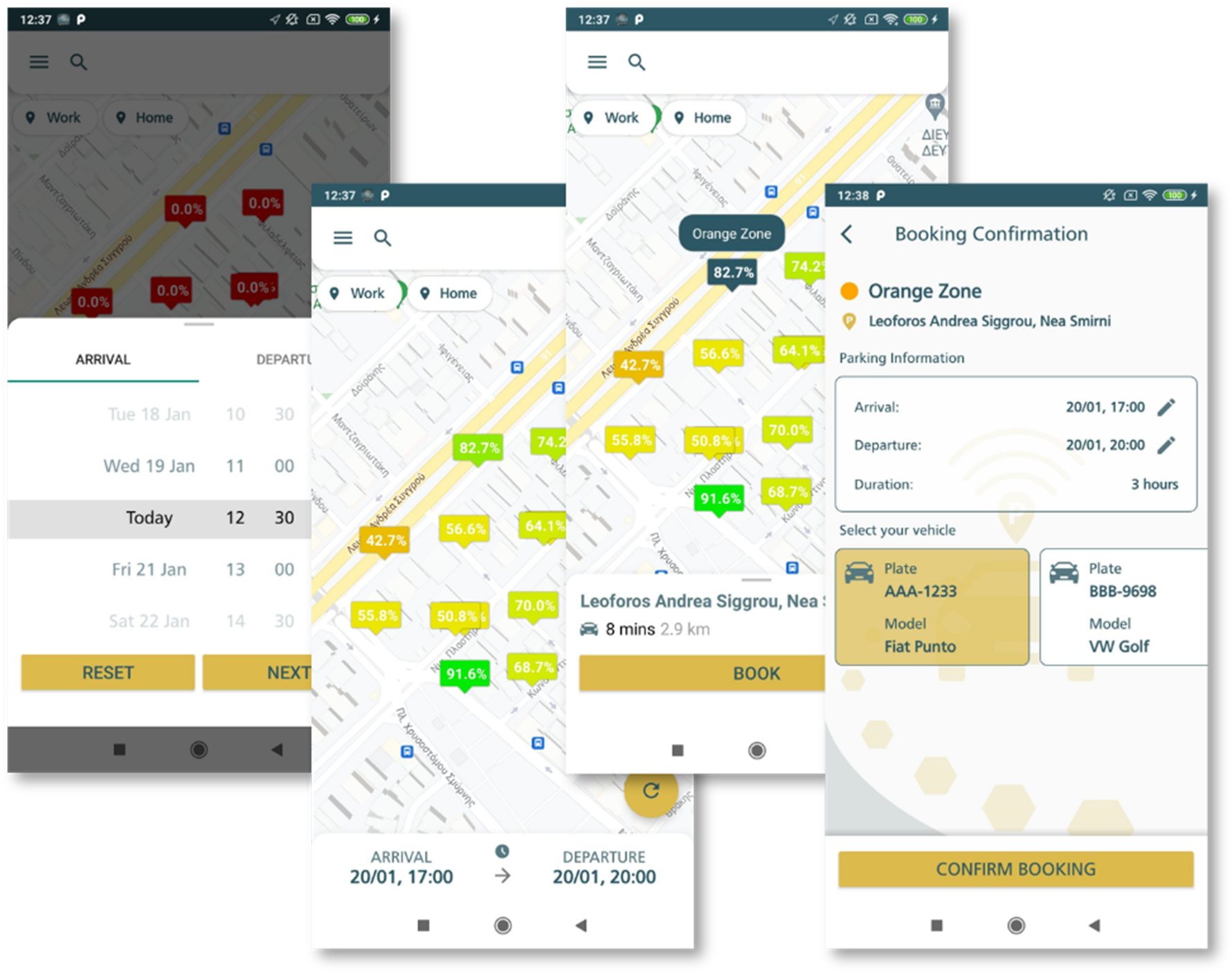
wi.MOVE Predictions
Get a quote
Recent Articles


